Kanab UT.
Just East of Kanab UT on Highway 89 is the Grand Plateau RV Park which was home to us for just over a week. We used this park as our “home base” during our stay in Kanab as it is centrally located to several activities we wanted to do in the area.
Now we have driven through Kanab many times on the way to Lake Powell for our boating trips and never gave Kanab much thought. This time we decided we would take some time and see what the area has to offer. Boy were we glad that we did. It is a great place to see some sites within 75 miles of our rig. Having our TOAD (Tow vehicle) made getting around very easy and we were able to see numerous sites. Below are the things we were able to do during our stay in Kanab.
MARBLE CANYON DRIVING LOOP
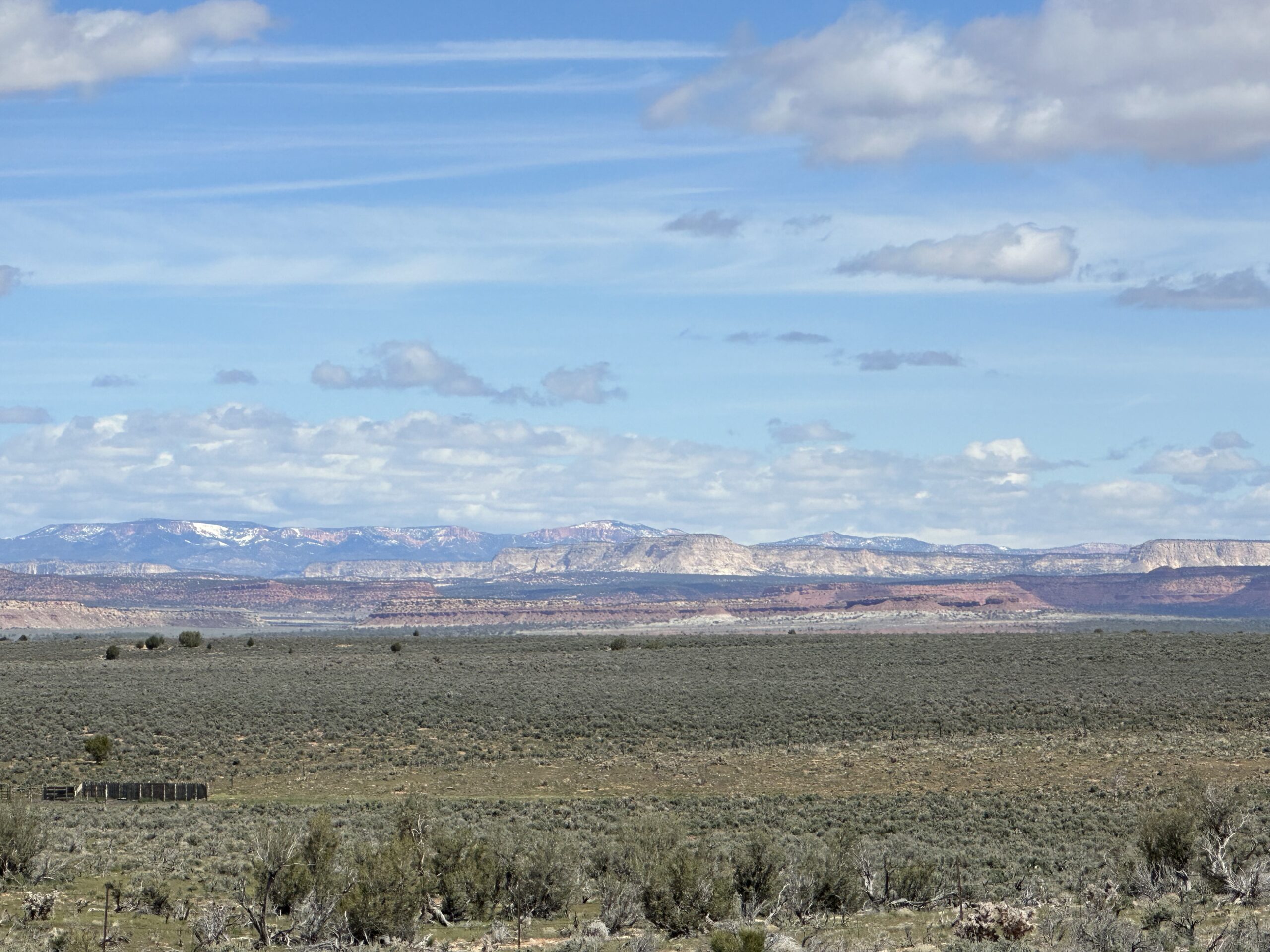
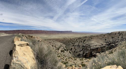
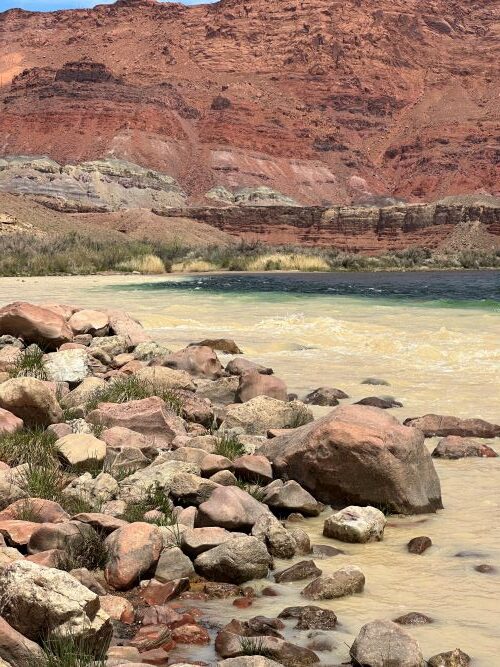
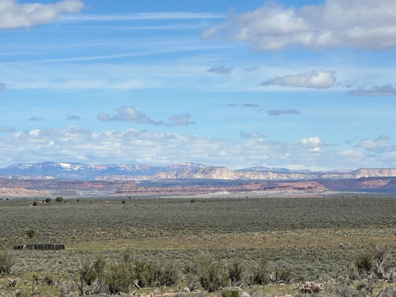
We stopped in at the local BLM Visitors Center to get some information on what to do. They were very helpful and gave us ideas and maps of the local area. They suggested we do the “North Rim – Page” driving loop as it was such a beautiful day. We took their advice, gassed up the TOAD and headed south of Kanab. Withing 15 minutes we were crossing the plains heading towards the North Rim of the Grand Canyon (spoiler – we knew the North Rim was still closed due to high snow levels). The road goes up to the forest and there are great places to see the views of the mountains to the east. We stopped at numerous places along the way that were indicated on the map and explored these locations. There is a scenic pullout at the top where you stop and take pictures of all the steps of the “Grand Escalate Staircase”. We then headed down into the desert on the way to the Vermillion Hills and Lee’s Ferry. A stop at Lee’s Ferry and we were standing alongside the Colorado River where it enters the start of the Grand Canyon. Pretty impressive.
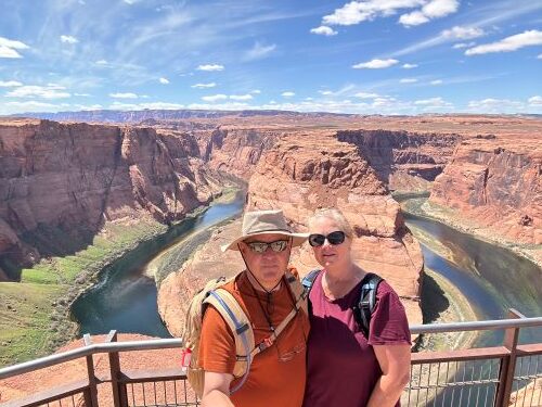
On the road again and we were headed to the infamous “Horseshoe Bend” overlook. Now I have always thought that Horseshoe Bend was located at the top of Lake Powell and was only accessible via an off-road adventure. We both were so surprised to learn that it is right outside Page AZ. We joked about how many times we had driven by this and did not stop because we did not know it was there. Imagine our surprise when we pulled up to the turn off and saw a huge parking lot with bathrooms and motorhome parking, bus drop off points and lots of people. Paid the $10/car fee (City of Page has a cash cow here) and parked. It’s a ¾ mile easy hike down to the viewpoint and it is worth every step. Taking pictures behind the railing is no problem for me but get me away from the rail and out in the open and I just cannot take it. I get queasy about heights now, don’t know why, never had it before but I got it now. Even watching other people get close to the edge freaks me out. Anyway, back in the car and off to Lake Powell we headed.
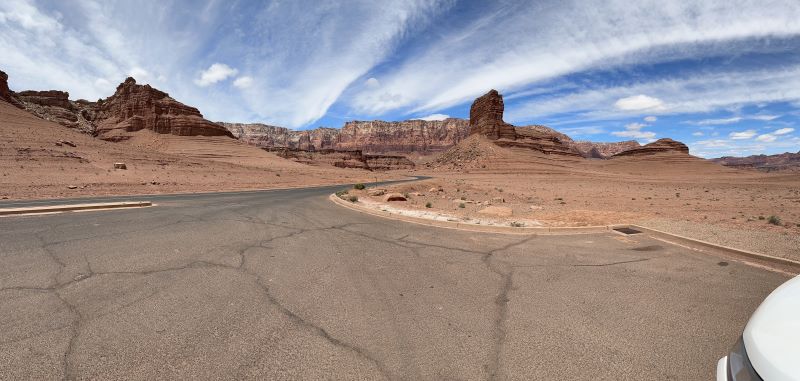
We crossed the bridge at Glen Canyon (always a favorite) and headed to Wahweap Marina. We have been here many times over the years, but we were not prepared for what we saw. The lake has gone down significantly, and I mean way down. We went to where we would rent the houseboats in the past wondering if they were still there due to the low water level. We parked and walked to a picnic table overlooking the bay (what’s left of it). We sat there, had some snacks, and looked through our binoculars at all the sites we used to marvel at from the houseboat on the way out and in. All of them are well above the water line now. In fact, the route we used to take the houseboat out into the lake is gone and is dry land now. We looked up the statistics and found the lake is at 22.3% capacity (yikes). Hopefully it will come up when the snow starts to melt this year. After reminiscing about past great trips, we were back in the TOAD headed for the RV Park. We stopped and saw a sign that said “Paria Townsite and Movie set” so off the main road we went down a dirt side road.
Now this drive was even more spectacular. The scenery was beautiful with changing landscapes with so many different colors. We drove to the end of the road and hiked to the trailhead. After a short hike we came to the Paria River. That’s when we could see the remains of the old townsite across the river. Nothing much, a single old house and some foundation ruins – no movie set, and we would have had to cross the river (flowing pretty good) to get there. We decided it was not worth it and headed back. We later learned the movie set burned down in the nineties – they should have put that on the sign but live and learn.
Back in the TOAD and off towards Kanab we went. We talked about how we missed so much here in all times we drove through the area. It’s amazing what you miss when you have limited time and must get to the destination, have your vacation, and then head right back.
WIRE PASS – BUCKSKIN GULTCH
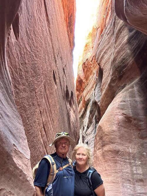
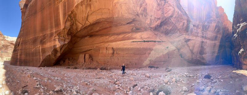
About 35 miles east of Kanab is a road called “House Rock Valley Road”. You take this road south about eight miles and you come to the Wire Pass trailhead. From here you start the hike to Wire Pass. It’s about a 3.5-4.0-hour hike depending on how much time you spend in awe of the canyons. We hiked out and came to the Wire Pass slot canyons. Talk about amazing, we hiked down the canyon until we could go no further due to a big drop off the recent water flows had created. We backtracked and found a crossover trail which will lead you over the top and down further into Wire Pass canyons. This is not an easy trail for older people. There are very steep portions which require some people to use their butts as the main tool to get down to the other side. We made it and continued into the slot canyons. This is an amazing hike through some very tight and high slot canyons. You come through Wire Pass and end up meeting up with Buckskin Gultch. This is a great intersection to take pictures and then decide if you go up some way towards Buckskin Gultch trailhead or go down and follow the canyons. We did a little of both. Going up was smooth sandy trail into a very large slot canyon. We went up for about 30 minutes and then went back down. At the intersection we went south for a bit but the trail was much more rocky and muddy so we only went south for bit and turned around.
Back at the intersection we stopped for some snacks, pictures and just some time to take in the beauty of this place. Then it was time to do it all in reverse, again the hardest part was the crossover trail. Some more breaks and soon we were back at the TOAD.
If you like slot canyon hiking this is a great experience. When we were there the weather was perfect (68 degrees F and clear) but beware of flash floods in the area. There are also petroglyphs in the area, but we could not find them.
COTTONWOOD CANYON ROAD
Directly east of Kanab about 31 miles is Cottonwood Canyon Road which runs from Bryce Canyon south all the way to the Marble loop in the Vermillion Hills area. We decided to do the north to south loop and drove to Bryce as a pre-trip for our formal trip to Bryce Canyon later in the week. You follow the map to the town of Tropic and then head south on the road. The signs warn you about the road being for high clearance vehicles and I would agree with them about this. The sign said 40 miles to Highway 89 and off we went.
The first thing we did was stop at Kodachrome State Park and drove through the park and campgrounds. There are some very interesting rock formations to see here at each end of the park. The scenery is beautiful and there is a small visitors center to get snacks and drinks if needed. It would be great to camp here because I imagine the night sky is something to see. A little too small and remote for our big Class A so off we went down the road.
Now the rest of the trip to Highway 89 took about 3 hrs. We stopped in several places to take pictures and have some lunch. We also stopped and hiked along a small slot canyon along the way and had the whole place to ourselves. There is ever changing scenery behind each turn and hill until you get towards the lower part of the road. It then turns to plains that look like a lunar landscape before dropping you out at Highway 89. Make sure you have plenty of water and a good spare tire just in case. We passed several people on the road in case of an emergency, but you are out there quite a way. Also, cell service is very limited. This is a great drive and is easily done in a good sturdy vehicle if it is not wet out. Looks like the road turns to mush whenever there is rain so make sure and check the weather.
Coral Pink Sand Dunes
West of Kanab about 30 minutes is the Coral Pink Sand Dunes State Park. It is an easy drive there to the visitor’s center. You can pay the $10 entry fee and go see the dunes and campgrounds. The sand is more orangish than pink if you ask me, but you can see where it came from and how it got it’s name. There are areas to walk out on to take pictures and you can rent sandboards and go down the dunes. Looks like fun until you must walk back up. Being from Southern California, we grew up in the Imperial Sand Dunes. We spent many a day at Glamis, so we know all about hiking in the dunes. We let the other tourists go out and hike the Coral Pink Dunes as we watched and compared the area to Glamis. It is weird seeing trees in the middle of the dunes and there is lots of riding outside the park on BLM land and trails as far as you can see.
After the visit to Coral Pink, we were off to Mount Carmel junction to play the only golf course for a lot of miles. If you get a chance stop in at the Thunderbird Golf Course and play a round for $15 PP with cart. It’s a quick nine-hole course in a beautiful area. The course was still waking up from winter and was in pretty rough shape, but we had fun anyway. Ask for Verne and he will give you all the details of the course.
Johnson Canyon
About 8 miles east of town is Johnson Canyon. We got a BLM map that showed different sights at different mile markers. One of the sites is the “Old Gunsmoke movie set”. It should say “Old Gunsmoke Movie Set Ruin” because that is what it is. Pretty much not what the picture shows. Anyway, this is another road that goes deep into the canyons and across the prairies to Highway 89 headed to Bryce. The road is well maintained, and I think pretty much any sturdy vehicle could drive it. Not as scenic as the other drives but fun to follow the mile markers and see the sights.
Share this post: on Twitter on Facebook on Google+